What is GoodVision?
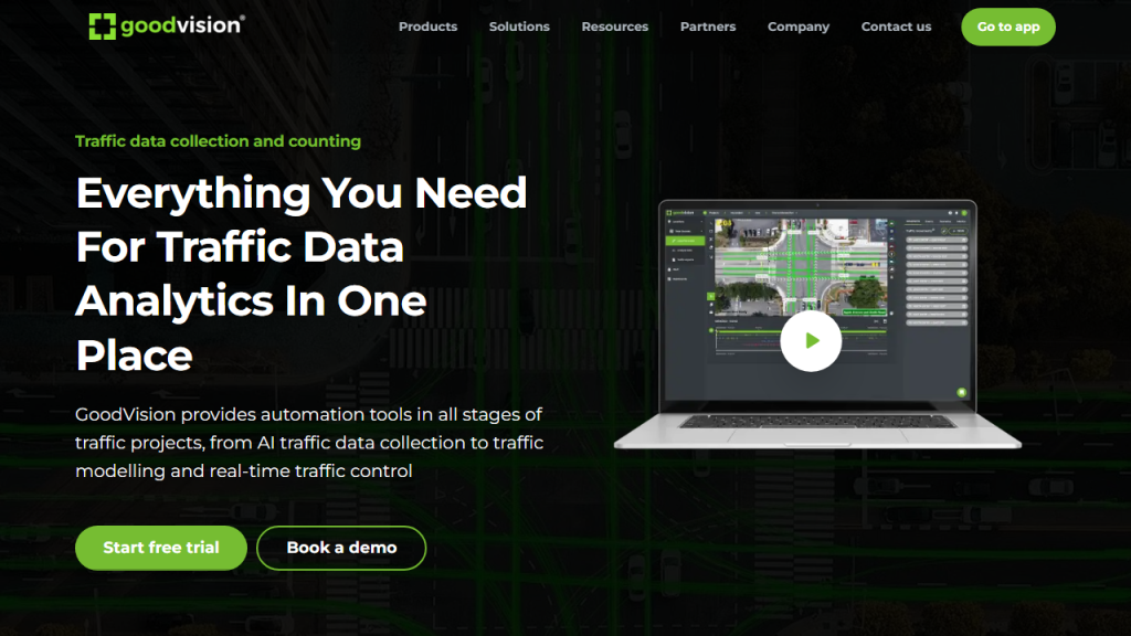
GoodVision is an innovative tool designed to enhance the capabilities of professionals in various fields such as architecture, construction, urban planning, and environmental monitoring. Utilizing advanced image recognition and artificial intelligence technologies, GoodVision provides users with the ability to analyze visual data from a multitude of sources, including aerial imagery, satellite images, and ground-level photographs. The tool focuses on transforming visual information into actionable insights, enabling users to make informed decisions based on accurate and detailed assessments.
One of the key functionalities of GoodVision is its capacity to identify and categorize various elements within images, such as buildings, vegetation, roads, and other infrastructure. This feature is particularly useful in urban planning where understanding the spatial distribution of resources is crucial. Additionally, GoodVision supports data integration from multiple sources, allowing for comprehensive analysis and reporting. Users can easily generate visual reports that summarize findings, trends, and statistics, making it easier to communicate complex information to stakeholders.
Furthermore, GoodVision is user-friendly, designed to cater to both technical and non-technical users. Its intuitive interface and customizable settings allow professionals to tailor the tool to their specific needs, which improves efficiency and productivity. Whether it’s for monitoring environmental changes, conducting site assessments, or managing development projects, GoodVision empowers users with the tools they need to visualize and analyze their data effectively.
Features
- Advanced Image Recognition: Identifies and categorizes various objects in images automatically.
- Multi-Source Data Integration: Combines and analyzes data from aerial, satellite, and ground-level images.
- Customizable Reporting: Generates tailored reports with visualizations and statistics based on user-defined parameters.
- User-Friendly Interface: Designed for ease of use, accommodating both technical and non-technical users.
- Real-Time Data Processing: Allows for immediate analysis and feedback on visual data.
Advantages
- Increased Efficiency: Streamlines the process of data analysis, saving time and resources.
- Enhanced Decision Making: Provides accurate insights that aid in informed decision-making.
- Improved Communication: Generates clear reports that facilitate discussions with stakeholders.
- Versatility: Applicable across various industries, including construction, urban planning, and environmental monitoring.
- Scalability: Adapts to different project sizes and complexities without compromising performance.
TL;DR
GoodVision is a powerful tool that utilizes AI to analyze visual data, providing insights for professionals in fields like architecture, construction, and urban planning.
FAQs
What types of images can GoodVision analyze?
GoodVision can analyze a variety of images, including aerial imagery, satellite photographs, and ground-level photos.
Is GoodVision suitable for non-technical users?
Yes, GoodVision features a user-friendly interface designed to accommodate both technical and non-technical users.
Can GoodVision generate reports?
Absolutely! GoodVision allows users to create customizable reports that include visualizations and statistical data.
How does GoodVision enhance decision-making?
By providing accurate and detailed visual insights, GoodVision helps users make informed decisions based on reliable data.
Is GoodVision scalable for large projects?
Yes, GoodVision is designed to be scalable, making it suitable for projects of varying sizes and complexities.
